Will the FAA Know If I Fly My Drone? 2026 Guide
By Alex Carter
The Direct Answer: Yes — More Than Most Pilots Realize
If you are asking will the FAA know if you fly your drone, the straightforward answer in 2026 is: more than ever before, yes — and the gap between theoretical surveillance capability and practical detection reality has narrowed dramatically in the past two years. A fully operational Remote ID broadcast system, an updated registration database, expanding airport detection infrastructure, and active law enforcement partnerships have combined to create a drone oversight environment that is no longer symbolic.
That does not mean a federal agent is actively watching every recreational flight over a suburban backyard in real time. The enforcement architecture is intelligence-driven and risk-weighted — resources concentrate on airports, high-security areas, and serious violations. But for anyone flying a registered drone in controlled airspace, the broadcast your drone is making right now is technically readable by any equipped receiver within range. For anyone flying unregistered in restricted airspace, the probability of detection and meaningful penalty has risen substantially from what it was in the early years of drone regulation.
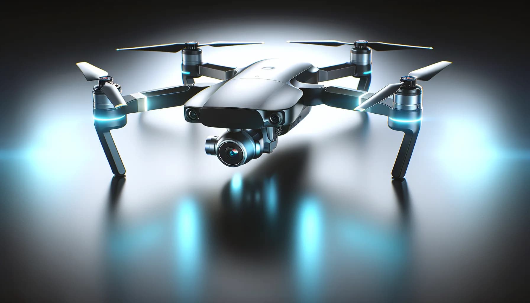
This comprehensive guide unpacks every dimension of how the FAA tracks, monitors, and enforces drone regulations in 2026. Whether you just purchased a DJI Mavic 3 Pro with Bitcoin through CryptoBitMart.com or you are an experienced pilot reviewing your compliance status, understanding the full picture protects your equipment, your record, and your ability to keep flying legally.
How Does FAA Drone Registration Work and Why Does It Matter?
FAA drone registration is the foundational layer of the agency’s awareness about who is flying what. Established under the FAA Modernization and Reform Act and refined through subsequent rulemaking, registration requirements create a federal database linking specific aircraft to specific owners — a database that becomes actionable when enforcement actions are initiated after a detected violation.
Any unmanned aircraft system (UAS) weighing more than 0.55 pounds — equivalent to 249 grams — must be registered with the FAA through its DroneZone portal at faadronezone.faa.gov before it is flown outdoors in the national airspace. The registration fee is $5 per registration certificate, valid for three years and covering all drones owned by a recreational registrant under one certificate. Commercial operators registering under Part 107 follow the same process but must also hold an active Remote Pilot Certificate issued through FAA testing.
Registration requires the operator’s full legal name, home address, and email address, along with a physical description of each drone. Upon completing registration, the FAA issues a unique registration number — formatted as FA followed by a series of digits — that must be marked on the exterior of the drone in a location accessible without tools. The marking must be legible, durable, and visible during a standard inspection. Operators who fail to mark their aircraft properly face the same penalties as those who fail to register at all.
The practical significance of registration for FAA awareness is this: when a Remote ID broadcast is detected, a law enforcement officer responds to a report of drone activity, or an incident investigation is initiated, the registration database is the primary tool for tracing an aircraft back to an operator. Without registration, that trace fails — which is precisely why the FAA treats operating an unregistered drone as a standalone violation separate from any airspace compliance issue. According to FAA operational data, over 900,000 recreational drone registrations were active in the United States through 2025, representing a significant percentage of the estimated consumer drone fleet in active use.
What Is Remote ID and How Does It Enable Real-Time Drone Tracking?
Remote ID is the technological backbone of the FAA’s modern drone monitoring capability, and it is the most consequential regulatory development for drone operators in the past decade. Fully enforced since March 2024 and now an operational reality across the national airspace in 2026, Remote ID requires drones to continuously broadcast identification and position data during flight — creating what the FAA describes as a digital license plate for unmanned aircraft operating in the national airspace.
The technical standard for Standard Remote ID requires drones to broadcast a specific set of data elements using radio frequency signals, typically Wi-Fi 6 or Bluetooth 5. The required broadcast package includes the drone’s unique identification number, its real-time GPS latitude and longitude, its altitude above the ground and above mean sea level, its velocity vector, the geographic coordinates of its takeoff point (known as the Control Station location), and a timestamp. This broadcast is continuous from takeoff to landing and does not require internet connectivity from the drone — it is a local radio transmission receivable by any compatible device within the signal range, typically 300 meters to 1 kilometer under normal conditions.
Network Remote ID extends this capability through an internet connection, transmitting flight data simultaneously to a UTM (Unmanned Traffic Management) service provider that aggregates location data into a centralized system. This is the component that enables authorities to monitor drone operations across large geographic areas without physical proximity to the aircraft. UTM service providers work in coordination with the FAA and can flag anomalies — unidentified drones in controlled airspace, aircraft deviating from approved flight plans, or operators whose Remote ID data conflicts with their filed intentions.
DJI has integrated Remote ID compliance into its entire current consumer product line. The DJI Mavic 3 series, Air 3 series, Mini 4 Pro, Mini 4K, and all current Avata and FPV models transmit Remote ID data when firmware is current and the feature is enabled in the DJI Fly or DJI RC application settings. Older DJI models not originally built with Remote ID hardware can achieve compliance through FAA-approved third-party Remote ID modules — small add-on devices that attach to the drone and broadcast the required data. Operating without Remote ID compliance in controlled airspace in 2026 is both a detectable violation and a prosecutable one.
Where Are Drone No-Fly Zones and How Are They Enforced?
No-fly zones are the most immediately consequential element of FAA drone regulation for day-to-day operators, and 2026’s airspace restriction map is more detailed, more dynamic, and more actively enforced than it was even two years ago. Understanding the geography of restricted airspace — and the mechanisms by which violations in those areas are detected — is non-negotiable for any drone operator flying in the United States.
The US airspace classification system divides national airspace into Classes A through G, each with specific drone operation rules. The most restrictive environments for drone operations are Class B airspace — the large, multi-layered airspace bubbles surrounding the nation’s busiest commercial airports, including LAX, JFK, O’Hare, and Atlanta Hartsfield. Class B airspace extends from the surface to 10,000 feet MSL and requires explicit ATC authorization for any aircraft, including drones. Flying a drone in Class B airspace without a LAANC authorization or a formal ATC clearance is a serious federal violation that airport operations centers are specifically equipped to detect.
The FAA’s LAANC (Low Altitude Authorization and Notification Capability) system is the primary mechanism for legally accessing controlled airspace. Available through the FAA’s own UAS Data Exchange portal and third-party providers including AirMap, Kittyhawk, and Aloft, LAANC provides near-instant automated authorization for drone flights in controlled airspace at approved altitudes — with more sensitive areas requiring manual FAA review. LAANC authorizations are tied to specific geographic areas and altitude ceilings, and the system logs both authorized and unauthorized operations in monitored airspace.
- Class B Airspace: Surrounds the busiest airports; absolute FAA authorization required; active detection systems deployed; highest enforcement priority
- Class C Airspace: Regional airports with significant passenger traffic; LAANC authorization required before flight; typically extends to 4,000 feet AGL
- Class D Airspace: Smaller airports with control towers; LAANC authorization required; typically extends to 2,500 feet AGL above airport elevation
- Class E Airspace: Controlled airspace extending down to 700 feet or 1,200 feet AGL in various configurations; surface Class E requires authorization; most of the continental US above 1,200 feet is Class E
- National Parks: National Park Service prohibits drone operations in most national parks; permit required for exceptions; active ranger enforcement
- Washington DC Special Flight Rules Area (SFRA): 30-nautical-mile ring around Reagan National; strict authorization requirements; immediate law enforcement response to violations
- Military Operations Areas (MOAs) and Restricted Areas: Active military airspace; drone intrusion triggers immediate military and civilian law enforcement response
- Critical Infrastructure: Power plants, water treatment facilities, dams, and certain bridges have expanding drone exclusion zones under enhanced critical infrastructure protection rules
- Stadiums and Sporting Events: TFRs issued for major sporting events; violations during active TFRs draw rapid enforcement response
Temporary Flight Restrictions are perhaps the most dynamically dangerous no-fly zone category for operators who do not check airspace before every single flight. TFRs are issued continuously by the FAA for Presidential movements, major security events, emergency operations, wildfire suppression activities, and other time-limited special circumstances. A TFR can be issued with as little as two hours’ notice and can restrict airspace in areas where drone operations were perfectly legal the day before. The FAA’s B4UFLY app and the official NOTAM system are the authoritative real-time sources for active TFRs — both should be checked immediately before every outdoor flight, not just initially when planning a session.
Can the FAA Track Your Drone in Real-Time Right Now?
The practical real-time tracking capability that the FAA and its partners have in 2026 depends on where you are flying and what equipment you are flying. The answer is genuinely location-dependent — the surveillance density near a major international airport is fundamentally different from the surveillance density in rural airspace away from any restricted zone.
In the vicinity of Class B airports — the 30 largest commercial airports in the United States — the answer is a clear yes. These airports deploy multi-modal UAS detection systems that combine RF signal monitoring, radar, optical cameras, and acoustic sensors to create a comprehensive airspace picture around the airport perimeter. Systems from vendors including Dedrone, DJI AeroScope, Elbit Systems Drone Guard, and Fortem Technologies are operational at dozens of major US airports, providing the capability to detect drone presence, identify RF signatures, and in many cases correlate detection data with Remote ID broadcasts to identify specific aircraft and operators.
At secondary airports with less dense monitoring infrastructure, real-time detection capability varies more significantly. Class C and D airports typically have some level of drone detection capability, but it may not be as comprehensive as major hub airports. Remote ID monitoring — the ability to receive and log the broadcasts from compliant drones — is increasingly available to airport security personnel through standard consumer and professional Remote ID receivers, meaning that a drone flying with active Remote ID in controlled airspace is creating a detectable and logged record even at airports without dedicated anti-drone systems.
In non-controlled airspace — Class G and rural Class E — the FAA’s real-time awareness of individual drone flights is substantially lower. There are no dense monitoring networks in agricultural fields, rural recreational areas, or most suburban residential zones. However, this does not mean the FAA is blind in these environments. Remote ID broadcasts are still detectable by any equipped receiver, including law enforcement vehicles equipped with monitoring tools, civilian bystanders using apps like OpenDroneID, and any future monitoring infrastructure deployed in the area. The absence of dense monitoring is not a guarantee of non-detection — it is simply a lower probability environment.
What Are the Actual Penalties for FAA Drone Violations?
Understanding the real penalty structure for drone regulation violations is essential for calibrating how seriously to take compliance obligations. The FAA’s drone enforcement framework in 2026 ranges from modest civil fines for minor technical violations to substantial criminal penalties for operations that create genuine safety hazards — and the agency has demonstrated willingness to pursue serious enforcement actions against operators who create real risks.
Civil penalties are the most common enforcement tool and apply to the broad range of regulatory violations that do not rise to criminal conduct. The FAA can impose civil penalties of up to $27,500 per violation per day for violations of federal aviation regulations, including drone-specific rules. In practice, first-time violations by clearly recreational operators who demonstrate compliance after the fact — registering immediately, grounding the drone, cooperating with the investigation — are typically resolved for amounts in the $500 to $5,000 range through the FAA’s settlement process. Repeat violations, cases involving controlled airspace near airports, and situations where the operator showed clear disregard for safety attract penalties toward the statutory maximum.
Criminal penalties apply when drone operations create genuine hazards to manned aircraft, violate national security flight restrictions, or involve knowing and willful violation of safety rules. Federal law provides for criminal fines and imprisonment of up to three years for the most serious drone violations. The FAA has referred multiple cases to federal prosecutors in recent years involving drone flights over major airports, near-miss incidents with commercial airliners on approach, and interference with emergency aircraft operations. These cases have resulted in federal convictions and serve as unambiguous deterrent examples.
Beyond federal penalties, state and local enforcement adds another layer. Multiple states have enacted drone-specific privacy laws creating civil liability for operators who fly over private property without permission, capture imagery of individuals without consent, or conduct drone operations that constitute surveillance or harassment. In some jurisdictions, these state-level violations can result in civil lawsuits with damages that far exceed the federal civil penalties — particularly in cases involving identifiable individuals captured on video without consent. The aggregate legal exposure from a single problematic drone flight can therefore combine federal civil penalties, potential federal criminal liability, and state civil lawsuit risk simultaneously.
Enforcement Data: The FAA reported issuing over 1,500 drone-related enforcement actions in 2024, with civil penalties totaling several million dollars across all cases. The agency specifically noted an increase in enforcement actions near major airports, attributing the increase to improved detection capability from newly deployed monitoring systems at the 15 busiest US commercial airports. This trend indicates that the FAA’s enforcement posture is actively intensifying, not remaining static.
Which Drones Are Exempt From FAA Registration and Remote ID?
Two categories of drone operation have genuine, legally defined exemptions from the full registration and Remote ID requirements, and understanding these precisely helps operators identify legitimate lower-compliance pathways without misjudging their scope.
The most commercially significant exemption is the sub-250g registration exclusion. Drones weighing 249 grams or less are exempt from FAA registration when flown for recreational purposes. This is why the DJI Mini series — the Mini 2 SE, Mini 3, Mini 3 Pro, Mini 4K, and Mini 4 Pro — are all engineered to land precisely under the 249-gram threshold. DJI has treated this weight class as a separate product category specifically because the registration exemption represents a meaningful reduction in compliance friction for first-time buyers and casual recreational flyers. However, this exemption is strictly limited to the registration obligation — sub-250g drones remain subject to all airspace restrictions, altitude limits, visual line of sight requirements, and the FAA’s community-based safety guidelines. They are also subject to Remote ID requirements in certain operational contexts despite the registration exemption.
Indoor flying is the second genuine exemption category. Drone flights conducted entirely indoors — in warehouses, production studios, sports halls, or private homes — take place outside the national airspace system and are therefore not subject to FAA airspace regulations, Remote ID requirements, or registration-linked operational rules. This exemption is legitimately used by drone racing operators, industrial inspection teams, and film production companies that conduct entirely interior operations. The exemption boundary is strictly physical: the moment the drone exits the building, it enters national airspace and becomes subject to the full regulatory framework.
A third relevant category — not a true exemption but a significantly simplified compliance pathway — is Section 44809 recreational flying, which allows recreational operators to fly without Part 107 certification provided they comply with community-based safety guidelines from an FAA-recognized CBO (Community Based Organization), fly within visual line of sight, stay below 400 feet AGL in uncontrolled airspace, keep their drone registered if over 249g, and comply with Remote ID requirements. This framework describes how the vast majority of recreational drone pilots legally operate in the United States and provides meaningful operational freedom within a compliant structure.
Practical Compliance Checklist: How to Stay Legal in 2026
Building consistent compliance habits as a drone operator does not require legal expertise — it requires building a short, disciplined pre-flight and registration routine that becomes automatic. The following framework covers every major compliance obligation that applies to recreational and commercial operators flying consumer drones in the United States in 2026.
- Register your drone (if over 249g): Visit FAA DroneZone, complete registration for $5, mark the registration number permanently on the aircraft exterior, and set a reminder for renewal three years from registration date.
- Enable Remote ID before every flight: Confirm Remote ID is active in your drone app (DJI Fly, DJI RC, etc.) before takeoff. Verify your drone’s firmware is current — Remote ID functionality improvements are delivered through firmware updates.
- Check airspace using B4UFLY or equivalent: Open the FAA’s B4UFLY app and enter your planned flight location on the day of every flight. Look for active TFRs, controlled airspace boundaries, and any special notices for your area.
- Request LAANC authorization if needed: If your flight location falls in Class B, C, D, or E controlled airspace, request authorization through LAANC before takeoff. Many authorizations are automated and near-instant; some require manual FAA review and advance notice.
- Maintain visual line of sight throughout the flight: Keep your drone in unaided visual sight range at all times during recreational operation. Do not fly beyond the distance at which you can clearly see and control the aircraft without a spotter.
- Respect the 400-foot AGL ceiling: Treat 400 feet above ground level as an absolute recreational altitude maximum. In Class G airspace around tall structures, the 400-foot rule extends to 400 feet above the structure for operations within 400 feet horizontally of it — but this exception is narrow and should be verified before relying on it.
- Never fly near emergency operations: Active emergency response — firefighting aircraft, police helicopters, search and rescue operations — creates automatic TFRs. If you see emergency activity, land your drone immediately regardless of whether you have received a formal TFR notification.
- Carry proof of registration: Keep a copy of your FAA registration certificate — physical or digital — accessible while flying. Law enforcement officers who respond to drone-related calls may request proof of registration as a first step in any compliance check.
For buyers who have recently purchased a new drone using Bitcoin or other cryptocurrencies through CryptoBitMart.com, compliance setup should happen before the first outdoor flight — not after. Register the drone the day you unbox it, update firmware to the current version, enable Remote ID in settings, and download B4UFLY on your phone. The combination of a properly equipped drone and an informed operator is what the FAA’s regulatory system is designed to produce — and it is what enables a lifetime of legal, enjoyable flying without legal risk.
Frequently Asked Questions: Will the FAA Know If I Fly My Drone?
Q: Will the FAA literally see my drone flight in real time if I fly recreationally?
In most recreational flying contexts — backyard flying in residential areas, open fields away from airports, rural locations in Class G airspace — the FAA does not have real-time active monitoring of individual recreational flights. However, your drone’s Remote ID broadcast is technically detectable by any equipped receiver within range at all times during flight, and airport-adjacent areas have active monitoring infrastructure that does create real-time awareness. The FAA’s enforcement resources are concentrated on controlled airspace and serious violations, not universal real-time surveillance of recreational flights.
Q: What actually happens if I fly my drone without registering it with the FAA?
Flying an unregistered drone weighing more than 249 grams is a violation of 49 USC 46306, carrying civil penalties of up to $27,500 and criminal penalties of up to $250,000 and three years imprisonment for willful violations. In practice, detected first-time violations by recreational operators typically resolve for $500 to $5,000 through the FAA’s civil penalty settlement process when the operator cooperates and comes into compliance. Violations involving additional aggravating factors — controlled airspace intrusion, near-misses with manned aircraft, or deliberate disregard for regulations — attract substantially higher penalties. Given that registration costs $5 and takes under 10 minutes, the compliance case is overwhelming.
Q: Does my DJI Mini 4K need to comply with Remote ID rules?
The DJI Mini 4K weighs under 249 grams and is therefore exempt from FAA registration for recreational use. However, exemption from registration does not provide blanket Remote ID exemption. When flying in controlled airspace or under certain operational contexts, Remote ID compliance may still be required. The DJI Mini 4K includes Remote ID functionality in its current firmware — enabling it in the DJI Fly app settings before flying in any area where it may be required is best practice. All standard airspace restrictions, the 400-foot AGL ceiling, visual line of sight requirements, and TFR compliance apply fully to sub-250g drones regardless of the registration exemption.
Q: How do I check for FAA no-fly zones before I take off?
Three tools cover the primary pre-flight airspace check. The FAA’s B4UFLY app is the official source — enter your location and it returns airspace class, active TFRs, and advisories updated in real time. DJI Fly’s integrated map loads geofencing data automatically and provides in-app warnings when your planned flight area approaches or enters restricted zones. AirMap and Aloft provide additional airspace intelligence including LAANC authorization request capability, making them particularly useful for pilots who regularly fly near controlled airspace. Check on the day of every flight — not the day before — as TFRs can be issued with very short notice for Presidential movements, sporting events, and emergency operations.
Q: Can I buy and fly a drone in the US if I purchased it with Bitcoin overseas?
Yes. The payment method and purchase location have no bearing on the FAA regulatory requirements that apply to operating a drone in US national airspace. A DJI Mavic 3 purchased with Bitcoin through an international crypto-native electronics retailer carries exactly the same registration, Remote ID, and airspace compliance requirements as one purchased at Best Buy in cash. What matters is the aircraft’s weight, the operational category under which you are flying, and where and how you operate it. Complete FAA registration through DroneZone before the first outdoor flight, enable Remote ID in the manufacturer’s app, and check B4UFLY before every session — compliance is defined by operation, not by purchase origin or payment method.
Related Articles
Ready to shop with crypto?
Browse 1,000+ brand-new devices and luxury goods — pay with Bitcoin, Ethereum and 50+ cryptocurrencies.
Shop the store

